


[VOICE 64.0 released: 11 11 2011]
VR GIS 64
This page updated: April, 2011
VOICE™
VOICE™ : Vector Overlay Information Classification Extrapolation.
This program is in transition from VR GIS to VR GIS 64.. This page is currently the same , however will change by the time VR GIS 64 is actually released. This is as of April, 2011.
-
- The Shape DBase 3 .dbf files are read and written using tdbf V6.3.2 database component. The Statgo Surgo Soil database displays are not included with this program anymore.
- VOICE™ : Vector Overlay Information Classification Extrapolation. Voice: overlays layers of 2D locations and database attributes. Edit shape files and their attribute databases. No longer uses any dll's or ocx's. Open (.shp files), edit, analyze, annotate, layout a legend, and print as a map. Extract Classified layers of objects having x,y coordinates and attribute information. The Import function is used to convert other file formats (USDA Dlgs, ...) into .shp files with attendant relational databases. other import functions do not have multiple relational databases linked to their .shp file.
(Layers: Hydrology, Vegetation, Soils, Transportation, Urban-utilities, and Elevation). U.S. Geological Survey software dlgv32
allows preview and evaluation of (USGS) data, (USGS) National Atlas. ArcExplorer® GIS software is developed and marketed by Environmental Systems Research Institute, Inc.
SOEST Generic Mapping Tools (GMT) has great data too.
Open (.shp), edit, project, analyze, annotate, layout a legend, and print as a map. It overlays 2D .shp files. Select objects to display attribute, Db data. Select layer-color-fill by attribute for map classification. Create the Legend and transform the layers into desired projection. Preview placement of Legend: Print Layout then print the map. VOICE is a 2D overlay with database attributes, not an image processor nor 3D synthesizer. Version 2.0 of GCTPC (c code) was rewritten into pascal for use in displaying data at various projections. To access the 'real' GCTPc, retrieve the file gctpc20.tar.Z by anonymous ftp from edcftp.cr.usgs.gov. Be advised that some .shp files have undocumented-proprietary links within the file and this program will Not Save these if the file is saved. It does have the capability to link attributes to external database files... that will not be read by other .shp file programs. This program also strips off any 3D Z or M measurements.
the new look... use the Menu, toolbar buttons, Right Click pop-up menu, or [Ctrl][Alt][Shift] and Mouse Left Click to activate-control Editing.
Locatable Editor Toolbars:
- Menu:
- Vector: Clear all, Open, Save, Save As, Import, Export, Options, Setup Printer, Print, [previously opened files], Exit
- Overlay: Fit to Window, Zoom Area, Pan, All Areas, Edit Layer only, Refresh, Bitmap Resize (many), Status at Top, Status at Bottom, Show X,Y, values
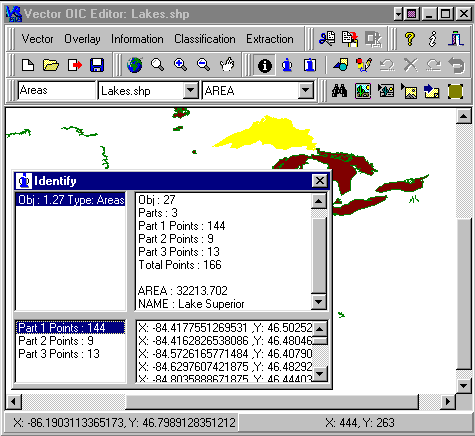
- Information: Object Info, Db Info, Edit Shape, Edit Point, Move, Delete, Copy+Move, Undo, Accept, Snap (..), Toolbars (..), Help, About
- Classification: Properties, Classify,
- Extraction: Find, Map, Legend, Print; Cut-Copy-Paste BMP
- Clipboard: Cut-Copy-Paste
- Attribute-DB-Soil DB Info(s), Shape-Point Edit(s), Move-Delete-Copy, Undo-Accept
- Shape type-Overlay Filename-Field Attributes
- Find-Properties-Classify-Map-Legend-Print Layout
Map Projection parameters another way
Map Projection parameters another way
Map Projection parameters
Map Projection input ranges
This program DOES NOT export files to .dxf always correctly... nor read all .shp files... requires memory to be available, and deletes 3D shape info and saves as 2D.


2 of my favorite graphics

 Copyright© 1991..2011 by Ivan Lee Herring

